


More accurate lane level positioning, map updates in real time, and the generation of local dynamic maps for ADAS applications – the EU-funded H2020 project inLane realized a huge step forward towards achieving these seemingly futuristic goals.
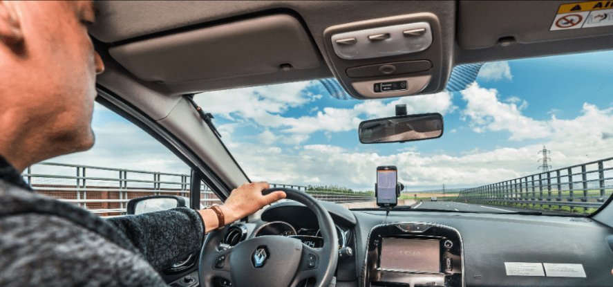
The project organised a well-attended and highly appreciated final event on 19 June at the RACC offices in the beautiful and sun engulfed city of Barcelona. During this event, the project officer from the European GNSS Agency highlighted the importance of the steps taken by inLane in advancing a vehicle’s ability to determine its exact position. The inLane technology allows a vehicle to identify the lane, as well as its position inside the lane as accurately as possible through a combination of low cost vehicle sensors such as gyroscopes, accelerometers and cameras and the enhanced positioning information provided by the new Galileo Satellite system. In addition to this ability, location information is also used to update maps in real-time and create local dynamic maps to advance tomorrows’ driver assistance systems.
inLane takes advantage of the enhanced geographic positioning services provided by the European Galileo satellite system. Galileo offers many advantages over the previously used and military-operated American GPS system. Especially the location accuracy and the improved support available when operating in urban canyons are an indispensable asset for automated or semi-automated vehicles. Today the Galileo system is fully operational and will lead to many new applications taking advantage of this platform. inLane proves that by using low cost sensors, many of them already available on the vehicle of today, in combination with navigation systems based on the Galileo satellite position systems, a most adequate solution for a precise vehicle location, a real-time continuous map update and scenery recognition is realistic. Although further research is still needed, the inLane results will prove to be a valuable basis for future innovation programs.
The main result of inLane is a set of software components which achieve detailed and accurate lane level positioning in turn-by-turn navigation systems. inLane also facilitated the development of real-time map updates with detailed information and traffic sign recognition thanks to the use of an innovative fusion of sensor data and computer vision technology. These are base components which support the evolution of todays’ car and truck towards the automated transport systems of tomorrow – especially for vehicle automation of SAE level 4 and 5, detailed scenery recognition, centimetre accurate positioning and location recognition abilities are crucial. Although level 5 cars may still be far away in the future, light automated vehicles transporting persons and goods in a dedicated area are already in use today, which means the inLane technology can be introduced and used already now.
inLane has greatly benefited from the evolving technological breakthroughs in the ICT and vehicle industry. Where in the past a mobile device and a vehicle were two distinct and separate things, today we clearly see a merger of these two entities. Microprocessors provide more computing power in a smaller footprint while consuming less electrical power. This leads to the availability of continuously improved and powerful edge systems and intelligent sensors installable in vehicles. The technological evolution enables not only the uptake of the inLane results, but also a shift in the mobility paradigm, where transport systems are used as a service and drive the need for advanced positioning and mapping systems such as those developed by the inLane project. The value offered by inLane includes enhanced cartography and lane navigation, an important improvement of ADAS systems, the evolution towards accurate navigation systems. Third party developers could use the inLane components as an API allowing them to implement innovative navigation and scenery recognition applications.
Clearly the inLane results focus on the automotive sector but may also benefit other technology and business domains such as drone manufacturers and drone services providers, civil protection and emergency organisations and law enforcement. Many more applications that could benefit from the inLane results can be imagined.
Related content: Lane-level navigation project closes successfully


